
July 30, 2025 — India is set to mark a historic moment in international space cooperation today with the launch of NISAR, an advanced Earth observation satellite developed jointly by the Indian Space Research Organisation (ISRO) and NASA (National Aeronautics and Space Administration). Scheduled for lift-off at 5:40 PM IST from the Satish Dhawan Space Centre in Sriharikota, this mission highlights a growing partnership between the two space powers.
A Milestone in India-US Space Collaboration
NISAR, short for NASA-ISRO Synthetic Aperture Radar, is the first satellite co-developed by ISRO and NASA. It represents nearly a decade of coordinated research, engineering, and technological exchange. The mission showcases how joint ventures in space can serve broader scientific goals while strengthening diplomatic ties.
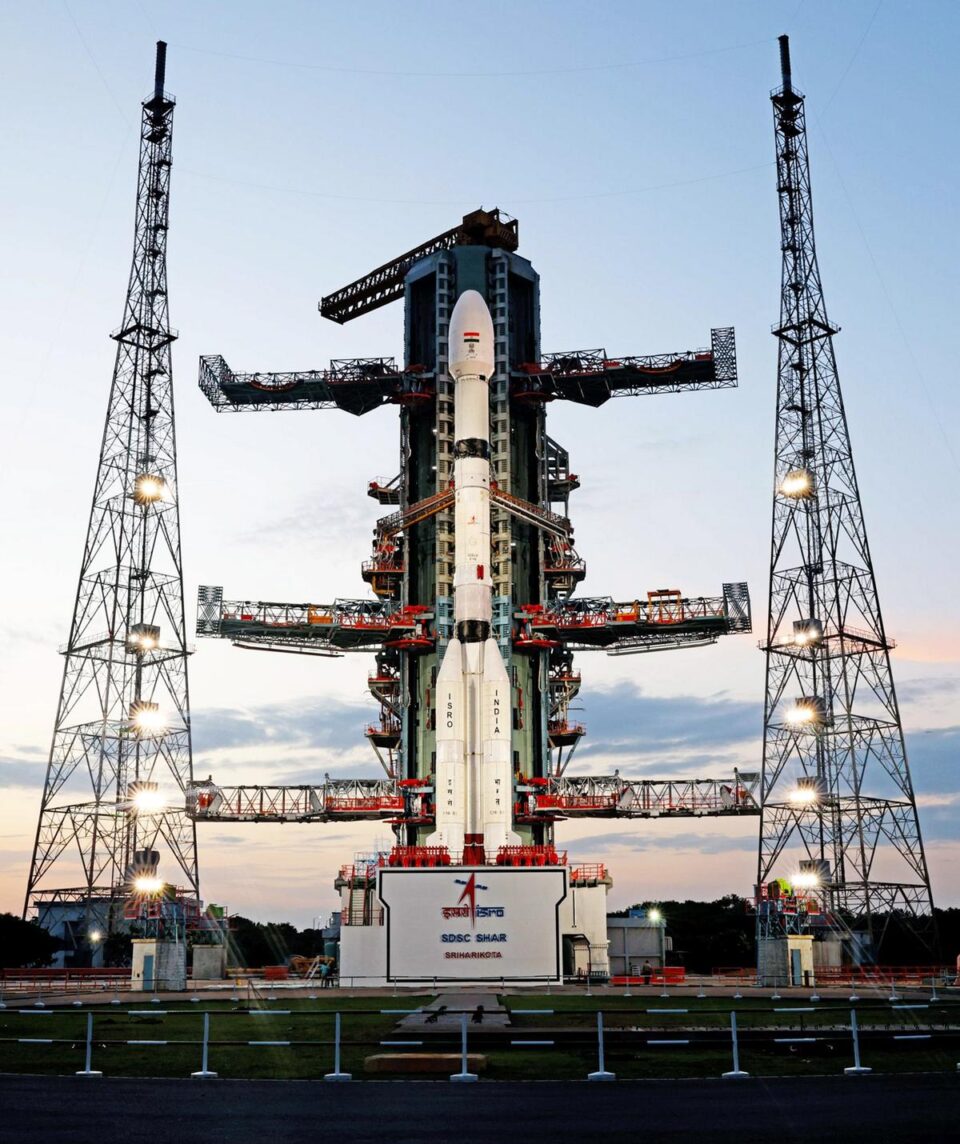
The satellite, weighing approximately 2,392 kilograms, will be launched aboard India’s GSLV-F16 (Geosynchronous Satellite Launch Vehicle). After a brief 19-minute flight, it will be placed in a sun-synchronous orbit about 740 kilometers above Earth.
What Will NISAR Do?
The mission is designed to provide high-resolution radar data for a variety of Earth science applications. Its key objectives include monitoring:
- Land deformation, such as earthquakes, landslides, and volcanoes
- Glacial movements and changes in polar ice
- Ecosystem dynamics, including forest cover and wetland changes
- Coastal and oceanic processes
By using dual-frequency radar systems—the L-band contributed by NASA and the S-band by ISRO—NISAR will be capable of capturing precise surface-level changes even through clouds and darkness. This makes it a powerful tool for understanding climate change, improving disaster response, and managing natural resources.
Countdown and Launch Preparations
ISRO confirmed that the final countdown began at 2:10 PM IST on Tuesday. In a statement, the agency announced:
“GSLV-F16/NISAR | Launch Day has arrived for GSLV-F16 & NISAR. GSLV-F16 is standing tall on the pad. NISAR is ready. Liftoff today at 17:40 hours IST from Sriharikota.”
Once NISAR reaches its intended orbit, it will enter a commissioning phase. During this time, onboard instruments will be activated and calibrated to ensure optimal performance before it begins full-scale data collection.
Shared Responsibilities and Global Benefits
While ISRO developed the launch vehicle and satellite structure, NASA provided the L-band radar, high-speed downlink systems, and GPS receivers. The integration of these systems over nearly ten years of collaboration highlights the mission’s complexity and global relevance.
The data collected by NISAR will be made available to scientists and researchers around the world, enabling broader studies in climate science, environmental monitoring, and sustainable development.
A Symbol of Scientific Unity
Beyond its technological achievements, NISAR symbolizes a shared vision between India and the United States—to leverage space technology for the betterment of humanity. With its ability to observe Earth’s most subtle changes, this satellite could provide the insights needed to address some of the most urgent challenges facing our planet today.
As the launch vehicle prepares for liftoff, all eyes are on Sriharikota for what promises to be a defining moment in global space collaboration.